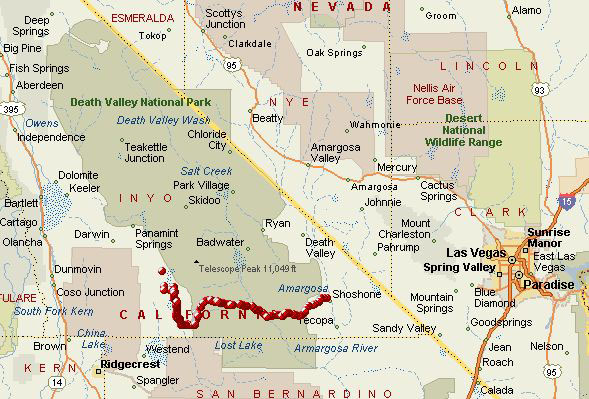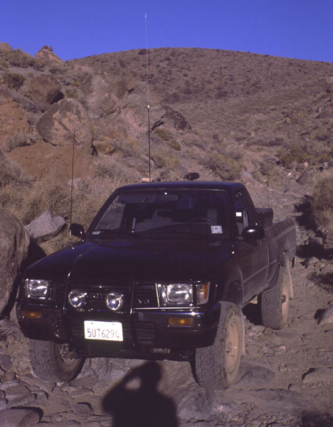
This page is a trip report of our December 2000 drive across southern Death Valley. On the way from Las Vegas to Fairfield, we decided to travel through the valley and cross the western (Panamint) mountains by four-wheel-drive roads. It was quite an exciting trip across the valley, lasting almost five hours. Details, maps, and photos are below.
The Route. The route took us from east to west across the southern part of Death Valley National Park. Death Valley is isolated by the Amargosa mountain range in the east, and the Panamint range in the west. Our plan was to enter the park on pavement, then cross west over the Panamint range by four-wheel drive trail. 
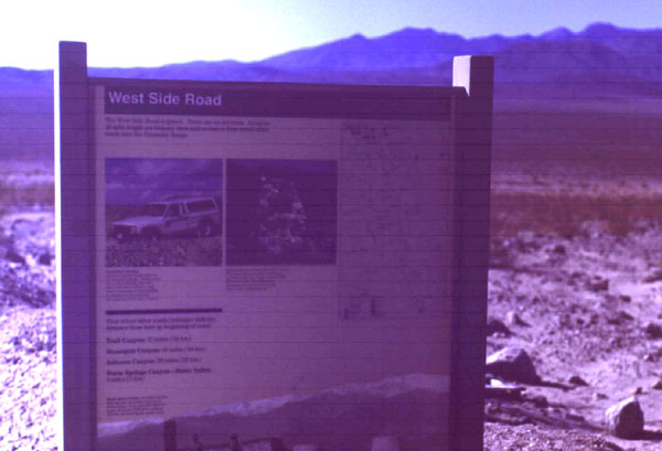
West Side Road. After entering the south side of the park, we folowed highway 178 past the Ashford Mill ruins, then branched off onto the West Side Road. This road runs up the west side of the valley, with elevations frequently quite a bit below sea level (in fact, Melanie, in the middle of a cold, had awful pain in one of her ears from the air pressure!). The road was wide, graded, and in good shape, and we followed it approximately 5 miles. 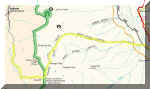
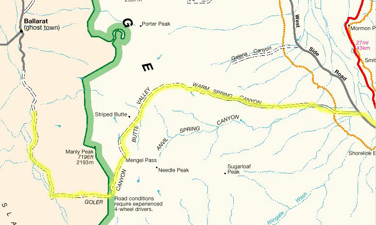
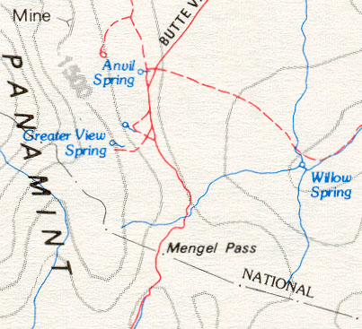
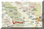
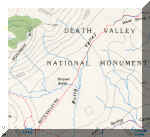
Over the Panamints. Leaving the West Side Road, the road over the Panamint Range begins with Butte Valley road. This road travels up Warm Springs Canyon, then on into Butte Canyon. After the road climbs over Mengel Pass, it turns into Coyote Canyon Road and descends Goler Wash. Pictured at left is a portion of the National Park Service map with the route highlighted in yellow. 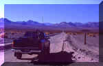
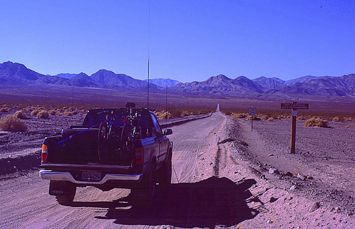
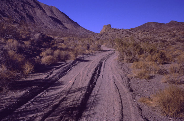
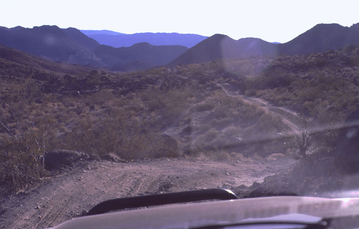
Starting up Butte Valley Road. Butte Valley road started as a nice, graded, sand and gravel road. Scenery was beautiful, and we drove west across the valley, slowly climbing towards the mountains in the west. Early on we encountered a couple coming from the west, who had difficulty with their long-wheelbase Toyota over the pass; they also somehow managed to tear both front mudflaps from their truck. 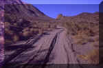
Climbing Butte Valley Road. The road continued to climb as we traveled through higher and higher elevations. Road conditions continued to be good: a nice sandy track through the desert. Along the way we encountered some motorcycle riders who needed air to fix a flat -- we had the air compressor, but couldn't help them because their patch kit was with another rider who was unable to make it up Goler wash and had to turn back. 
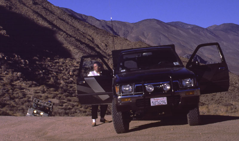
Satellite View of our Track Across the Desert. To be sure we were on the right course, we used GPS satellite navigation along the route. The mapping information displayed on the GPS, along with the topographical map, allowed us to be sure we were on the right trail throughout the trip. Since there were numerous forks, we really didn't want to wind up going the wrong direction! The view at left shows the track log recorded by the GPS. 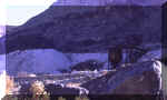
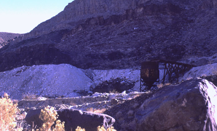
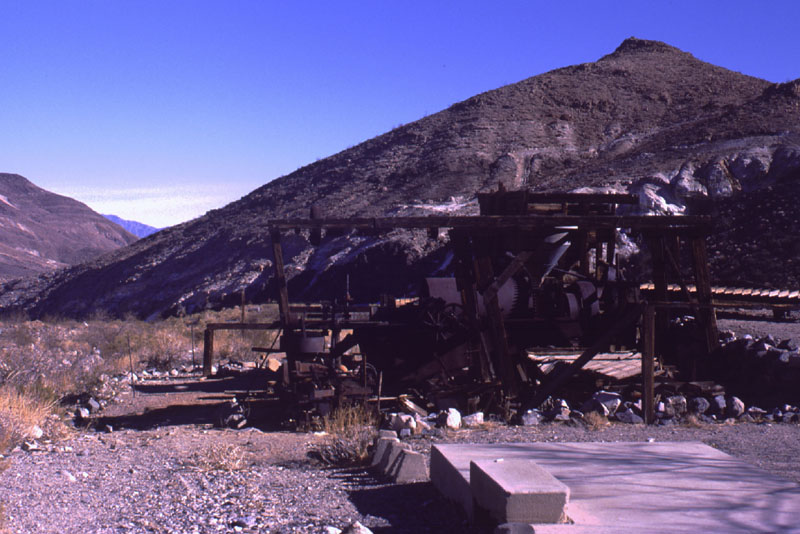
Abandoned Mine, Warm Springs Canyon. Once we climbed into Warm Springs Canyon, we saw lots of old mining activity. Open mineshafts dotted the hills on either side of the canyon, and tailing piles were scattered on the slopes. Occasionally we'd see abandoned machinery, such as pictured here. 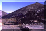
Abandoned Mine. Another abandoned mine in Warm Springs Canyon had lots of foundations, mineshafts, and rusting equipment. Also in the background were numerous abandoned miner's cabins. This point marked the end of the "good" road and the beginning of the high clearance 4WD part of the route: From here on over the mountains, the road was more of a trail made up of loose sand, gravel, rocks, and boulders.
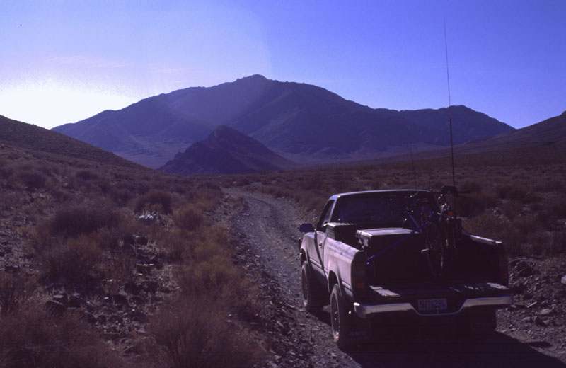
Butte Valley. This high desert valley is 4000' above Death Valley just 15 miles (line-of-sight) to the east. The topo map showed a relatively good route towards Mengel Pass in the west.. 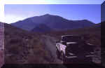
Climbing towards Butte Valley. After several hours we made the last part of the climb before we reached Butte Valley. Near this point we encountered two vehicles coming from the other direction, who reported Mengel Pass to be difficult but passable. 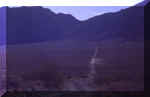
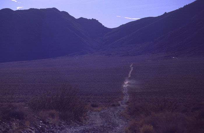
Other 4WD Drivers in the Distance. Once in the valley, we had a clear view of the road across to the pass. On the opposite (west) side of the valley, there are more abandoned cabins in the hills; these are often used overnight by travelers through this area. Once the road crosses the valley (as pictured), it turns left (south) to go over the pass. Off in the distance we could see two other vehicles going our same direction. 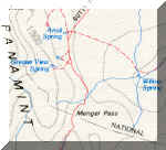
Mengel Pass. The road towards Mengel Pass on the west side of Butte Valley was quite exciting. After passing by the cabins near Greater View Spring, the sandy + rocky trail turned quite difficult. From here to the pass, the trail consisted of hard-packed and loose sand, studded with rocks of numerous sizes. The trail was never level, either ascending or descending (sometimes very steeply!), and frequently off-camber with nerve-wracking pitches to the left and right. Numerous times we had to get out and walk the trail ahead to decide the best route. Three times we scraped our way over large rocks. 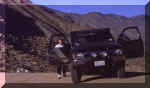
Reaching Mengel Pass. After a few miles of really rough climbing, we reached the pass. Fortunately, the two vehicles that we had spotted ahead of us had stopped at the cabins and were now behind us, so we didn't feel completely alone in the trip towards the pass. One of the two can be seen climbing towards the pass at left. 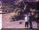
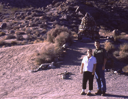
Stone Marker, Mengel Pass. The summit is marked with a stone cairn -- of course we had to set the self-timer on the camera and run to get a picture! 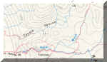
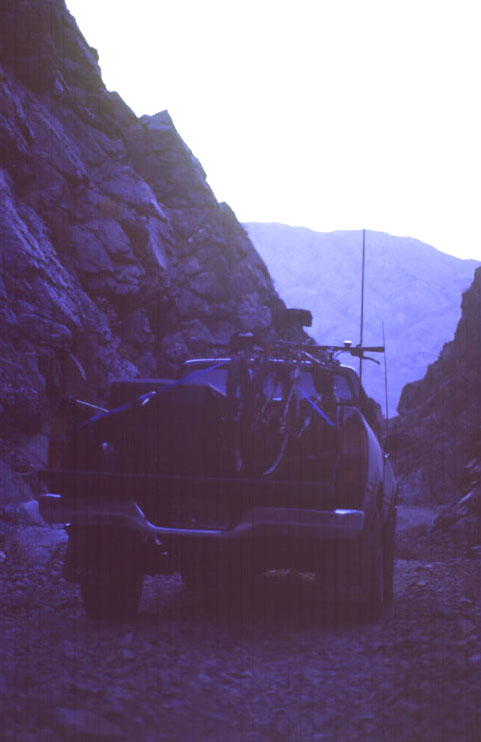
Goler Wash. The next part of the route was marked on the topo map with a dotted line (suggesting it was even worse than what we had just gone through!). The road descends from the pass down Coyote Canyon through Goler Wash. All the information I could find about this route said that Goler Wash was the most difficult part of the trip, but I hoped that since we were going east-to-west, and descending, we could use gravity to help us over the difficult stuff. 
Descending from the Pass to the Wash. The trail to the wash was rough but entirely passable. Lots of big boulders and rocks, but not too many off-camber sections, and not too much loose sand. As long as we drove slowly (we hadn't been out of 4-low second gear since the mines!) things were stable. 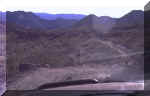
Trail from Mengel Pass to Goler Wash. At left is a driver's view shot of the trail descending down towards the wash. Interesting angles in this shot, plus, the road seems to disappear! 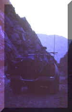
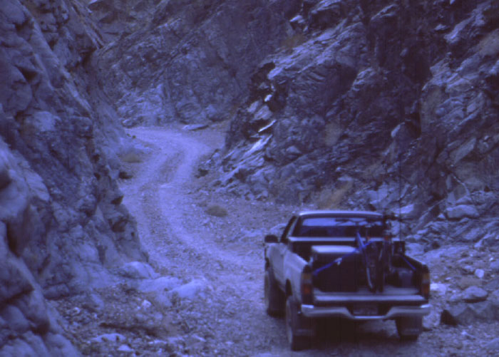
Pausing in the Canyon. The sun was close to setting, and we wanted to be out of Goler Wash by night, and it looked like we were going to make it. The wash had more loose rocks and boulders, but going downhill was relatively easy. 
Goler Wash. More of the wash. Steep canyon walls extended several hundred feet on either side of the trail. 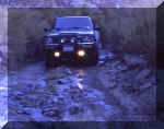
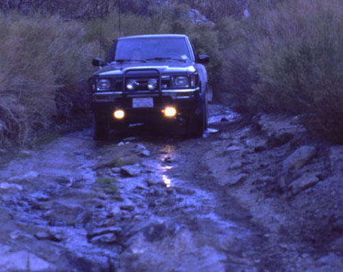
Water in Goler Wash. After not seeing any signs of water for several hours, it was quite exciting to see water running down the wash as we descended. 
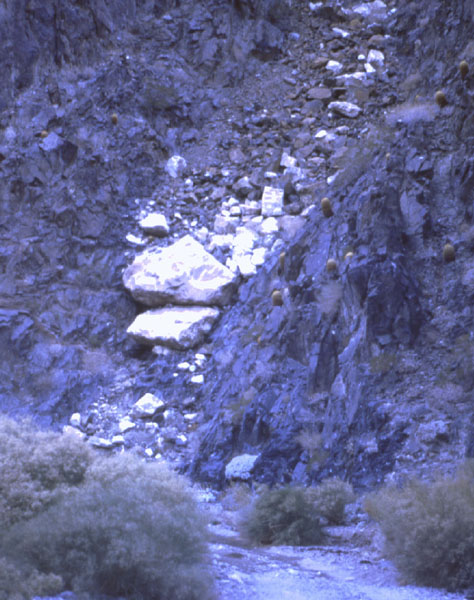
Hanging Boulders, Goler Wash. At several places along the canyon walls, giant boulders are wedged into gaps in the rock. Piled on these boulders are heaps of smaller boulders and other rocks. Not the place I'd want to be in a flash flood! Note the barrel cacti dot the rock walls in this area.
I was able to meet up with the regular ham radio group on 14.339 MHz around this time -- with cell phone service out of range for hours, and no VHF or UHF repeaters nearby, it's always nice to use the HF radio to chat with people from such an isolated area!!
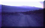
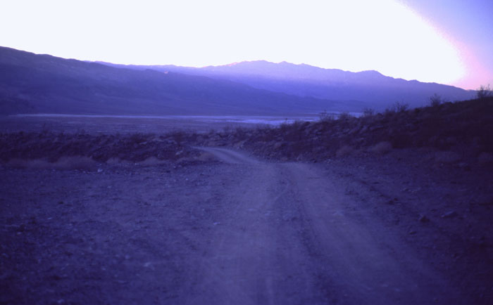
Panamint Valley. Just after the sun set we reached Panamint Valley (elevation approx. 1000') and the end of the 4WD road. We continued north up the valley on the rough washboarded sand road for approx. 15 miles towards the ghost town of Ballarat. Next we turned west for several miles, got on to our first paved road in five hours, and continued north towards home (only 9 hours away!). 
Postscript: Dings and Scratches. Other than some minor scrapes on the underside of the truck (sure am glad they protect the differential drain plug with an armor ring!), the only other sign we'd been trail-riding was the dust on the wheels and numerous fine scratches along the sides of the truck. They'll come out...
More Information
The National Park Service's Death Valley page, contains up-to-the-minute information on everything about the park.
Roger Brown's excellent Death Valley page, with many links to information and trip reports in the Death Valley area.
Photography (c) 2000 Dave and Melanie Productions. .
Last revised: January 04, 2001.